- Home
- Places to Go
- Downtown
- Lakes
- Mountains
- Museums
- National Parks and Monuments
- Rivers
- State and Local Parks
- Trail Systems
- Wilderness Areas and Forests
- Home
- Things To Do
- Agritourism and Farms
- Arts
- Attractions
- Family Friendly
- Guides
- Health, Spas, and Wellness
- Outdoor Adventure
- Scenic Drives
- Shopping
- Home
- Lodging
- Bed and Breakfasts
- Cabins
- Campgrounds and RV Parks
- Hotels and Motels
- Lodges
- Vacation Rentals
- Home
- Eat
- Bars, Distilleries, and Wine
- Breakfast and Brunch
- Breweries and Grills
- Casual and Family-Friendly Dining
- Coffee and Tea Shops
- Farm-to-Table
- Fine Dining Options
- Food Trucks
- International Dining
Backpacking
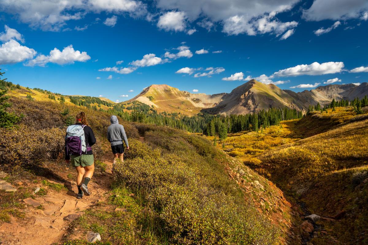
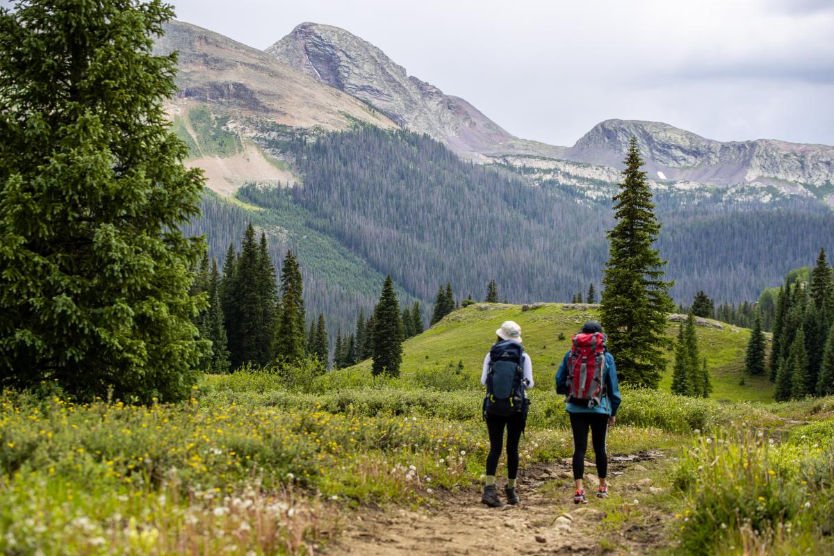
Backpacking is a core part of mountain culture. It’s a long-held Colorado tradition that beckons adventurers, old and new, to see the unspoiled majesty of the backcountry. For some, backpacking is a right of passage, a quick weekend getaway, or a weeks-long adventure into the unknown.
Whatever your plans are, the Durango area has opportunities to strike it out into the nearby wilderness. From Durango, backpackers have unlimited access to the San Juan National Forest, the Weminuche Wilderness, and the La Plata Mountains. There are also a wealth of learning resources, gear shops, and backpacking experts in town that can help you step confidently into the wild.
It’s can be an all-year affair too, with plentiful opportunities for mid-winter expeditions. If you want to live out your fantasy of striking it out on the frontier, there’s no better place than Durango.
Places to Go Backpacking
Visitors to Durango will gawk at the sheer number of places to explore outside the city. If you want to see all backpacking destinations, book multiple trips since you could spend a lifetime perusing them. Many landscapes exist, from canyons to mountain ranges and alpine lakes.
The fact that Durango is one of the best places for outdoor pursuits is known to outdoor enthusiasts across the globe.
Be advised that most routes on this page are snow-covered by early October and do not clear until late May. For high-altitude backpackers, it is recommended that you break camp at treeline to avoid exposure.
La Plata Canyon

Though part of a small subrange of the San Juan Mountains, there are many trails to traverse in La Plata Canyon. To avoid slick mud, backpackers may want to wait to hit the trails until mid-June. Except for the La Plata Canyon and Neptune Creek OHV trails, most routes seldom experience high foot traffic, leaving the door open for a solitary backpacking experience.
Naturally, the most accessible trail to find is the La Plata Canyon trail, which is approximately 9.25 miles and leads to the top of Kennebec Pass, where hikers can hook up with the 486-mile Colorado Trail. The trail gains 2,800 feet of elevation reasonably quickly but consists of primarily smooth gravel with a few rough sections after the fourth mile. Backpackers can disperse camp along the trail, keeping their camps on public lands.
Backpackers can access a few multi-use OHV trails from the La Plata Canyon trail that can double as overnight routes.
One of the first detours from the La Plata Canyon trail is the 8.4-mile Bedrock Creek Trail, which gains a whopping 3,192 feet up rough gravel until it reaches Gibbs Peak (12,268 feet). Various spots are open for dispersed camping along this route. From here, you can either double back or continue along a fantastic saddle loop that summits Star Peak (11,746 feet), Madden Peak (11,654 feet), and Parrot Peak (11,854 feet) before making a final descent that ends near Snowslide Campground.
Further along the canyon, backpackers can find the Neptune Creek OHV trail, a 3-mile route that begins at the La Plata City historic site. It has multiple spots along its many gravel switchbacks to set up camp. This trail gains almost 2,400 feet of elevation and can be particularly challenging for beginner backpackers. Eventually, the OHV trail becomes a dirt 1.7-mile social path leading to Deadwood's summit (12,285 feet) and Silver Mountain (12,496 feet). This route, which gains almost 1,400 feet of elevation, is handy if you camp overnight and for an early morning summit.
Another excellent trail to investigate is the 2.2-mile Basin Creek OHV trail. This is a straightforward route that leisurely gains 700 feet on smooth gravel. Intrepid backpackers can disperse camp near any of the abandoned mines in the area, and plenty of tree coverage limits exposure located on the earlier sections of the trails. If you’re looking to bag a peak, the trail can eventually lead to Diorite Peak (12,761 feet).
Finally, the last run-off trail to explore is the out-and-back 2.1-mile Columbus Basin trail, which initially descends almost 1,200 feet through spruce and aspen forests. However, the trail is very rocky, so be sure to wear boots with adequate ankle protection. This trail is especially great for backpackers looking for an easy initial hike, though they must make up the elevation on the way back. Along the trail are many open grassy areas perfect for setting up camp.
Missionary Ridge Area
A local favorite for its proximity to Durango, the Missionary Ridge area is a prime place for a short weekend getaway. The trail system itself is 28 miles in length and consists of five trails: Steven’s Creek Trail (7.25 miles), Haflin Creek Trail (3.9 miles), Red Creek Trail (4.4 miles), First Fork Trail (3.5 miles), and Missionary Ridge Trail (9 miles). Most of these routes gain elevation leisurely on primarily dirt paths. Given its proximity to Durango, there is moderate foot traffic throughout the entire trail system during all four seasons.
If you’re looking to save weight, the first three trails on the list have access to non-potable creek water that can be purified through various methods. Visitors to this trail system will have plenty of opportunities to break camp along the routes, provided they stay on public lands. It offers exceptional views of the Animas River Valley, the 2002 Missionary Ridge Fire area, and the San Juan and La Plata Mountains.
Backpackers can marvel at a great aspen forest near the top of the ridge. Here’s a pro tip: backpackers should visit this area during Veteran’s Day or Independence Day to get eye-level views of the fireworks in Durango.
Molas Pass Area

Molas Pass is an exceptional area near Silverton, Colorado, with grand views of the San Juan Mountains. It is potentially the start of the Colorado Trail (486 miles) thru-hike adventure. Backpackers can also section hike Molas Trail and Elk Creek Trail, which are sections of the Colorado Trail that can be hiked in the spring or summer. Be advised that these routes experience heavy traffic as they are a part of one of the most popular thru-hikes in Colorado.
Molas Trail (4.4 miles) descends a rocky path to grassy, riparian meadows next to the creek. It also offers fantastic views of the Grenadier Range to the southeast and the Needle Mountains to the southwest. Eventually, you’ll drop 1,500 feet and meet the Animas River.
Elk Creek Trail (8.9 miles) continues from the confluence of the Animas and Elk Creek waters. It continues southeast along the northern border of the Grenadier Range with views of Arrow Peak (13,809 feet) and Vestal Peak (13,870 feet). Most of the trail is dirt, though there are sections where you’ll have to negotiate boulder paths.
It is difficult in most areas on these trails to find a place to disperse camp since you must stay away from any water source within 100 feet. To that end, you may have to walk off the beaten path to find campsites, as both trails follow the Animas River and Elk Creek.
Coal Bank Pass Area
Between Durango and Silverton lies the Coal Bank Pass area, along Colorado’s most famous road: San Juan Skyway National Scenic Byway. With Engineer Mountain (12,970 feet) looming above and Cascade Creek snaking down below, this region enchants even the most seasoned outdoors people.
One of the best backpacking experiences in this area is the 6.1-mile, out-and-back Engineer Mountain Trail. The trail starts at 10,671 feet just off of the byway, cuts through a towering spruce forest, and eventually weaves through alpine meadows at the base of Engineer Mountain. In the morning, you can summit the peak less than 30 minutes from the treeline and enjoy a beautiful sunrise. Be warned: the last half mile can be particularly treacherous with its abundance of loose scree. It is also highly trafficked for its popularity.
Further below, to the south, backpackers may want to check out Cascade Creek Trail (8.1 miles). This trail presents little challenges for beginner backpackers as it only gains 853 feet. It is also less trafficked than the Engineer Mountain Trail and sticks primarily to dirt paths and footbridges. Finding a campsite not within 100 feet of Cascade Creek may be challenging. That said, it is well worth it for the abundance of magical waterfalls.
Vallecito and Lemon Reservoir Areas
The Vallecito and Lemon Reservoir areas are home to some of the highest manmade lakes in Colorado. With rolling hills, distant 14ers, and forests of spruce-fir and ponderosa, these locations beckon backpackers from around the state. Unlike some other high-country backpacking destinations, the Vallecito Lake Trail system is located about 18 miles northeast of Durango, with many routes to traverse. Starting from the reservoir, most of these trails have a steep 1,000-foot increase in elevation rock. Over time, you’ll gain 2,000 more feet on gentler grades on dirt. The difficulty varies from trail to trail, but most are intermediate challenges.
Two miles to the west, the Lemon Reservoir trail system has just one route: Youngs Canyon Trail. It gains about 2,000 feet of elevation up rocky paths in 4.5 miles, and you’ll have to ford a stream to continue on from the trailhead.
Things to Know About Backpacking in Durango
-
Watch out for private property signs if you’re exploring the La Plata Mountains.
-
Try getting as close as possible to a stream source before purifying to avoid drinking water polluted with animal pathogens or mine run-off.
-
Bring a rain shell or other water protection if you backpack in the late summer.
-
If you plan on going into the backcountry, leave an itinerary of your trip with someone you trust. Also, bring a satellite-capable communication device if you can afford it.
-
Bring plenty of water and food with you.
Care for Durango
-
Check out all trail information well in advance of your trip.
-
Know and obey the fire restrictions before heading out.
-
Do not disperse camp within 100 feet of any water source.
-
Please pack out all trash and waste, including your pet's waste.
-
Protect fragile alpine environments and stay on marked trails.
-
Follow Leave No Trace (LNT) principles.
-
Dogs must be leashed or otherwise physically restrained. Do not leave pets unattended.
-
Store your food in a designated bear cache, vault, or hang.


